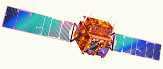
Indian Remote Sensing Satellites-IRS
United States, Russia, France and Japan are ahead of India in this list.
This data and information are based on information related to agriculture, forestry, water management, hydrology, list of crops and estimates, forest mapping, degradation of land and, desert expansion, soil mapping, flood and dry mapping, geological water discovery, mineral oil and minerals Searches and their assessment, mapping of land erosion in coastal areas, urban and rural land use etc.
Such 3 remote sensing satellites have been launched by India, which are as follows:-
IRS-1A
 IRS-1A, India's first remote sensing satellite was successfully launched in space by a Soviet satellite launcher- "Vostok" from the Soviet Space Center in Baikonur on 17 March, 1988.
In this remote sensing satellite, 3 powerful cameras called LISS (Linear Imaging Self Scanning Sensor) have been installed with the help of which the picture of a wide area of 148 sq km can be drawn easily at one time and out of which 72 kilometer wide terrain can also be easily identified. The name of these camera's are:- LISS-I, II A, II B respectively.
The most prominent contribution of these pictures was to detect underground water resources, so that more than 200000 tube wells could be installed. Apart from this, significant help was also received in the direction of the storms of the sea storms and floods in Ganga and Brahmaputra rivers. By the way, the life of this satellite was fixed at only 3 years but after 6 years of its field, it has been performing efficiently.
IRS-1B
 This is the second satellite of the first series "IRS" of Indian remote sensing satellites. On August 20, 1991, it was successfully launched by the Vostok satellite launch vehicle from the Baikonur Space Launch Center of the Soviet Union and was installed in its pre-determined orbit. This satellite is similar to the first satellite to IRS-1A, but only the detection capability of the LISS cameras in it has already been doubled.
This satellite completes a revolution of the Earth in 103 minutes and it takes 22 days to observe the entire Indian subcontinent. After the launch of this, both remote sensing satellites work together for 11 days and provide official information and information about the country's natural resources and weather. Both of these satellites are working as an important part of the nation's ambitious National Natural Resources Management System and are the main basis of this system.
IRS-1E
 From the Sriharikota launch site on September 20, 1993, the 850 kilograms loaded and 44-meter satellite "IRS-1E" was launched by the first Polar Satellite Launch Vehicle-PSLV, which was manufactured from indigenous technology, but it was burnt out when the launch vehicle's Flex Nozzle become worse after reaching in 3rd phase of launch vehicle.
IRS-P2
 On October 15, 1994, the Polar Satellite Launch "PSLV-D2" was launched from Sriharikota Launch Center. The height of this satellite, built at a cost of Rs 75 crores, is 44 meters. The weight of this satellite is 283 tonnes, and in cylindrical form it is made of aluminum pane (like bee-hive structure). In order to generate energy, a solar panels of 510 watt capacity have been arranged in which concrete earth sensory and sun sensor devices have been installed in three layers.
The satellite have a "LISS-2" camera, installed in the sun-synchronous orbit (near to the Polar region), has been activated by communicating the signal from ISRO's Telemetry Tracking and Control Network (TTCN) located in Pinea near Bangalore. The LISS-2 camera is capable of taking pictures of the 131-kilometer strip.
IRS-1C
 The state-of-the-art remote sensing satellite "IRS-1C" was launched successfully on December 28, 1995 through Molniya Rocket from Baikonur. With the launch of this satellite weighing 1250 kg, India became a member of the prestigious "cooperation institute" of competent countries in the "Construction Operation Control and Application of Remote Sensing Satellites". Apart from India, other countries of this association are: - United States, France, China, Russia, Japan, Canada and European Space Agency.
IRS-P3
 With the help of PSLV, India successfully launched a remote sensing satellite-IRS-P3, on March 21, 1996, with the help of its indigenous satellite launch vehicle, PSLV, and took another step forward in the field of space technology.
IRS-1D
 On December 29, 1997, India successfully launched the indigenous satellite-built remote sensing satellite "IRS-1D from Sriharikota range. This indigenous satellite (with the highest weight of 1200 kg and with state-of-the-art equipments) was also launched from "PSLV-C1" launcher vehicle.
Check our Mysterious articles:


0 Comment Here:
Post a Comment
Share your Feedback