Jio Celebration Offer 2018
Islands That are Mysteriously Ruined By Creatures
Learn Free Ethical Hacking Tutorials
MS Dhoni-Full Biography
Tips to Gain Weight in Just 20 Days
5 Amazing Toothpaste Beauty Hacks - You Must Try
Unknown and Amazing facts about Technology
How to Get Rid of dandruff - 100% working Home Remedies
Join us on Pinterest

Monday, June 25, 2018

// // Leave a Comment

Indian Space Program-Remote Sensing Satellites (Part-5)

Indian Remote Sensing Satellites-IRS


Remote sensing is a very useful technique by which the use of land at the global level, the area of ​​crop and the integration of its production, the warning of floods and droughts and their magnitude, the implementation of the scheme of agriculture according to the weather, underground water And finding minerals and estimating their quantity, survey of forest resources, the development and assessment of fishery resources, etc. is done. In order to do this, authentic and reliable information is obtained by the scraping method without touching the objects hidden in oceans, mountains, rivers, forests and in the ground.

Through its remote sensing satellites, India has become the fifth country in the world with such satellites and through them it is also receiving critical and useful data and important information that discharges its vital role in national development.

United States, Russia, France and Japan are ahead of India in this list.

This data and information are based on information related to agriculture, forestry, water management, hydrology, list of crops and estimates, forest mapping, degradation of land and, desert expansion, soil mapping, flood and dry mapping, geological water discovery, mineral oil and minerals Searches and their assessment, mapping of land erosion in coastal areas, urban and rural land use etc.

Such 3 remote sensing satellites have been launched by India, which are as follows:-


IRS-1A


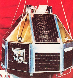
IRS-1A SatelliteIRS-1A, India's first remote sensing satellite was successfully launched in space by a Soviet satellite launcher- "Vostok" from the Soviet Space Center in Baikonur on 17 March, 1988.

In this remote sensing satellite, 3 powerful cameras called LISS (Linear Imaging Self Scanning Sensor) have been installed with the help of which the picture of a wide area of 148 sq km can be drawn easily at one time and out of which 72 kilometer wide terrain can also be easily identified. The name of these camera's are:- LISS-I, II A, II B respectively.

In Passing of 55 times above India during its initial 3 year tenure, this satellite sent 3,50,000 high quality pictures to ISRO headquarters in Bangalore and five other regional "Remote Sensing Service Centers-RSSC" situated at Dehradun, Bangalore, Nagpur, Kharagpur and Jodhpur. They have been an important role in different areas in the direction of India's development.

The most prominent contribution of these pictures was to detect underground water resources, so that more than 200000 tube wells could be installed.  Apart from this, significant help was also received in the direction of the storms of the sea storms and floods in Ganga and Brahmaputra rivers. By the way, the life of this satellite was fixed at only 3 years but after 6 years of its field, it has been performing efficiently.


IRS-1B

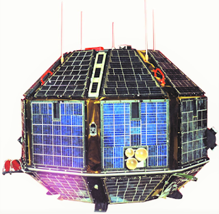
IRS-1B SatelliteThis is the second satellite of the first series "IRS" of Indian remote sensing satellites. On August 20, 1991, it was successfully launched by the Vostok satellite launch vehicle from the Baikonur Space Launch Center of the Soviet Union and was installed in its pre-determined orbit. This satellite is similar to the first satellite to IRS-1A, but only the detection capability of the LISS cameras in it has already been doubled.

This satellite completes a revolution of the Earth in 103 minutes and it takes 22 days to observe the entire Indian subcontinent. After the launch of this, both remote sensing satellites work together for 11 days and provide official information and information about the country's natural resources and weather. Both of these satellites are working as an important part of the nation's ambitious National Natural Resources Management System and are the main basis of this system.


IRS-1E
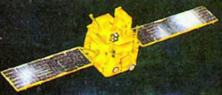

IRS-1E SatelliteFrom the Sriharikota launch site on September 20, 1993, the 850 kilograms loaded and 44-meter satellite "IRS-1E" was launched by the first Polar Satellite Launch Vehicle-PSLV, which was manufactured from indigenous technology, but it was burnt out when the launch vehicle's Flex Nozzle become worse after reaching in 3rd phase of launch vehicle.


IRS-P2


IRS-P2 SatelliteOn October 15, 1994, the Polar Satellite Launch "PSLV-D2" was launched from Sriharikota Launch Center. The height of this satellite, built at a cost of Rs 75 crores, is 44 meters. The weight of this satellite is 283 tonnes, and in cylindrical form it is made of aluminum pane (like bee-hive structure). In order to generate energy, a solar panels of 510 watt capacity have been arranged in which concrete earth sensory and sun sensor devices have been installed in three layers.

The satellite have a  "LISS-2" camera, installed in the sun-synchronous orbit (near to the Polar region),  has been activated by communicating the signal from ISRO's Telemetry Tracking and Control Network (TTCN) located in Pinea near Bangalore. The LISS-2 camera is capable of taking pictures of the 131-kilometer strip.

IRS-1C


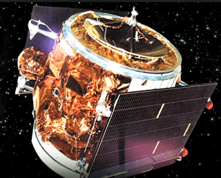
IRS-1C/1D SatelliteThe state-of-the-art remote sensing satellite "IRS-1C" was launched successfully on December 28, 1995 through Molniya Rocket from Baikonur. With the launch of this satellite weighing 1250 kg, India became a member of the prestigious "cooperation institute" of competent countries in the "Construction Operation Control and Application of Remote Sensing Satellites". Apart from India, other countries of this association are: - United States, France, China, Russia, Japan, Canada and European Space Agency.


IRS-P3


IRS-P3 SatelliteWith the help of PSLV, India successfully launched a remote sensing satellite-IRS-P3, on March 21, 1996, with the help of its indigenous satellite launch vehicle, PSLV, and took another step forward in the field of space technology.


IRS-1D


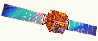
IRS-1C/1D SatelliteOn December 29, 1997, India successfully launched the indigenous satellite-built remote sensing satellite "IRS-1D from Sriharikota range. This indigenous satellite (with the highest weight of 1200 kg and with state-of-the-art equipments) was also launched from "PSLV-C1" launcher vehicle.

Check our Mysterious articles:


Read More
// // Leave a Comment

Indian Space Program - Part 4

Indian space scientists provided a concrete shape to the launch of 'Stretched Rohini Satellite Series - SROSS' by making changes in the technology of the general Rohini satellites launched. For this, they used "Enhanced Satellite Launch Vehicle", based on fully indigenous technology, in place of Foreign Vehicle SLV-3.

After this, 3 satellites of this series SROSS-1, SROSS-2, SROSS-3 and three launchers ASLV-D1, ASLV-D2 and ASLV-D3 were launched in space.


SROSS-1 Satellite and ASLV-D1 Launch Vehicle


SROSS-1 Satellite
SROSS-1
On March 24, 1987, the first satellite SROSS-1 of the extended Rohini series (from Sriharikota Launch Station) was launched in space with the help of augmented satellite launcher 'ASLV-D1', but only after 153 seconds of launch, due to technological failure in the launcher vehicle, it was destroyed with the satellite and fell into the Bay of Bengal.

Thus, the launcher vehicle, built for the purpose of launching out-of-the-air satellites, failed in its pilot flight, and it also badly affects the creation of satellites with overloaded loads made by indigenous technology in the country.


SROSS-2 Satellite and ASLV-D2 Launch Vehicle


SROSS-2 Satellite
SROSS-2
The second satellite SROSS-2 of the extended Rohini series was launched from Sriharikota launch center on 13 July 1988 through the second generation satellite launcher ASLV-D2 but it was also unsuccessful as after 2 minute 20 second, the Satellite burnt in air.

Failure of two consecutive experimental flights shocked the Indian space program and it was also suspected that the creation and development of future Polar Satellite Launch Vehicle (PSLV) is not possible in such circumstances. The usefulness of Sriharikota Launch Center was also questioned for this work but due to the intensive scrutiny of the reasons for these failures, the third experimental flight was successful.


SROSS-3 Satellite and ASLV-D3 Launch Vehicle


SROSS-3 Satellite
SROSS-3
From the Sriharikota launch center on May 20, 1992, the third and last satellite SROSS-3 of the extended Rohini series was launched in space with the help of augmented satellite launcher ASLV-D3. This become successful and it set the satellite of 106 kilograms in a fixed class at an altitude of 450 km. The minimum distance of the Earth from its orbit is 261 kilometers and the maximum distance is 420 kilometers.

This satellite revolves around Earth in a rotation of 92 minutes. In this satellite, Retraction Potassium Analyzer (RPA) is also used in addition to the instruments used for study of gamma ray. After this success, India's position has been established in the frontline of developing countries along with Israel and Brazil.


SROSS-C2 and ASLV-D4 Launch Vehicle 


On May 4, 1994, the last satellite SROSS-C2 of the Rohini series was successfully launched through the Promoter Flight ASLV-D4.

Read More

Sunday, June 24, 2018

// // Leave a Comment

Indian Space Program - Part 3


Rohini SeriesThe main objective of launching satellites of the Rohini series by India was to test the country's first satellite launch vehicle SLV-3 and launch 4 satellites of 30 to 40 kilograms of the series, by launching this vehicle to check the actual capacity of its rockets because these vehicles were being seen as the cornerstone of the construction of future rockets of the country.

Although only two of the four planets that were launched under this series succeeded, but this proved to be an interim halt for the development of small launch vehicles of the country. After this, the Indian space program entered a new era of development where the journey of development of Satellite launch vehicles and Polar satellite launch vehicles began.


Launch of Rohini: First Experimental flight


The first experimental flight of SLV-3 with "Rohini" satellite took place on Sriharikota launch site on August 10, 1969, but it could not be successful due to the failure of control system of the second segment of the vehicle, it got destroyed and fell into the Bay of Bengal immediately after the launch, the Rohini satellite placed on it was also destroyed.


Successful launch of Rohini RS-1: Second Experimental Flight


Rohini RS-1 SatelliteOn July 18, 1980, the second flight of the SLV-3 took place at 8:04 am from Sriharikota launch site and it was successful as it made some basic amendments, along with removing the responsive shortcomings for the failure of the first experimental flight. With the successful flight of this vehicle, the satellite RS-1 of Rohini series was successfully launched.

It is known that despite successful launch, the RS-1 could not be installed in its fixed class and its minimum distance from Earth was 276 kilometers instead of 308 kilometers and the maximum distance was 472 kilometers instead of 910 kilometers. Because of this, its period had been changed to 1 year instead of pre-determined 7 days and it remained efficient in its class till 23 July 1981. 


It is of course that the historic success of its successful launch has given the Indian space program a new direction. India became the sixth country in the world with indigenous technology and developed launch vehicle, in which Soviet Union, United States, France, Japan and China are already included.

Launch of Rohini RS-D1: Third Experimental Flight

Rohini RS-D1 SatelliteOn May 31, 1981, the third flight of satellite launch vehicle SLV-3 at Sriharikota satellite launch site, which was its first developmental flight, proved to be unsuccessful in establishing RS-D1, the third satellite of the Rohini series in the fixed class. Although this vehicle successfully launched Rohini RS-D1, it could not be delivered to the fixed class.

The result was that the planet was destroyed in only one week despite the designated age limit of 300 days.

Successful Launch of Rohini RS-D2: Fourth Experimental Flight

Rohini RS-D2 SatelliteAbout two years after the unfortunate failure of Rohini RS-D1, on April 17, 1983, SLV-3 rocket was successfully launched with the fourth of the Rohini series and country's eighth satellite Rohini RS-D2. This 41.5 kilograms satellite was installed in its fixed class and this success proved SLV-3 to be an authentic launch vehicle.

The most important thing about this satellite was that it included a solid-state camera of two bands called "Smart Sensor" for the purpose of photographing various parts of the earth during the orbiting by exploring the conditions of crops, water, fallow land, cloud, ice etc. which successfully performed the task.

Will be Continued>>

Further read-
Read More
// // Leave a Comment

Indian Space Program - Part 2

In our previous article of Indian Space Program-Part-1, we have talked about an introductory part of Indian Space Journey, Let's Talk about milestones of Success, Gained by ISRO in detail, click here to read Part-1 of this article.


Aryabhata

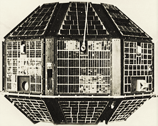
Aryabhata- India's First SatelliteIt was launched in space on April 19, 1975 by the Soviet Rocket Inter Cosmos. This was the first satellite of the country. This satellite was made from indigenous technology and was launched at 12:52 pm according to Indian time. It was 307 kg in weight. It entered Earth's orbit above Indonesia at 1:28 a.m., which was later established in its predetermined orbit at an elevation of 594 kilometers.

With the successful launch of this satellite, India has become the second nation after the China in the developing countries and eleventh nation in the world in the field of space research. Nations that launch satellite in space before India are the United States, the Soviet Union, Germany, China, France, England, Australia, Canada, Japan, and Italy.

Aryabhata was the first satellite developed by ISRO, developed as a scientific satellite. It was a nearly circular compound made of 26 flat elements, it's diameter was 1.6 meters and 1.2 meters in height. This satellite was to be used for X-ray, astronomy, air science experiment and solar physics experiment in its brief working hours of March 6. Aryabhata did them efficiently, although the procedure of this satellite was only pegged to 6 months it remained in space until March 1980.


Bhaskara Series

With the successful launch of its first satellite Aryabhata, the Indian scientific Geo-projection satellite was oriented towards the creation of "Bhaskara" and in this series, two planets named Bhaskara-I and Bhaskara-II were produced and successfully launched.


Bhaskara-I

Bhaskara I SatelliteThis was an experimental Ground-launch satellite, launched from the Soviet Cosmodrome on June 7, 1979. The weight of this satellite was 444 kilograms, height was 1.18 meters and diameter was 1.55 meters. This satellite was installed in its predetermined orbit at a height of 525 kilometers from the Earth and measured entire India three times of its 104 terrestrial planets, in its lifetime (2 years).


The speed of data transmission of this satellite was much more than that of "Aryabhata", because 250 orders could be given by its modern and complex order system, while Aryabhata was able to take only 35 orders. Bhaskara-I was also 84 kilograms more than Aryabhata in terms of weight.


With this satellite two major remote sensing policymakers (television camera system and microwave window system) were taken.

Important data were obtained from two television cameras and three microscopic radiogamy instruments installed in this satellite, including meteorological information such as sea surface temperature, sea breeze, atmospheric humidity, mapping of flood affected and flood free areas, in addition to meteorological information. This satellite has been successful in achieving its Geo-related targets of glaciation, snow fall, forestry, hydrology, geophysical compositions and ocean science.


Bhaskara-II

Bhaskara II SatelliteIn Bhaskara Series, a second and last satellite named "Bhaskara-II" was launched on November 20, 1981 with Soviet Cosmodrome and by launching it, an attempt to remove all the flaws existing in Bhaskara-I was made. Due to Bhaskara-I's placement, its technical nature, i.e. size, policy structure and systems were kept almost same and it was also installed in orbit at a height of 525 km from the earth.

The distance of this satellite, (controlled by Sriharikota and Ahmedabad based control rooms) was kept perpendicular to its class room, which facilitates proper deployment of its television cameras. There were also two television cameras installed in it, which were able to take a clear picture of land area of ​​340 sq km.

Satellite Microwave Radiometer- SAMIRIt included three Satellite Microwave Radiometer-SAMIR which was capable of measuring 340 square kilometers. Apart from this, it was also able to identify items of distance of 100 meters due to their extreme sensitivity. They had the ability to work in all times and every season.

Through the SAMIR devices engaged in this satellite, success has been achieved in analyzing marine surfaces, maritime conditions, the amount of water vapor in any area, the arrival of floods and its landing, and the occurrence of melting and melting of ice etc.


APPLE


APPLE- First Telecommunication satelliteAPPLE was an experiment in the direction of telecommunications satellites whose full name is "Ariane Passenger PayLoad Experiment"This satellite was launched on June 19, 1981 by the Ariane Rocket of the European Space Agency. This was the result of the design and construction of the entire Indian resources. It's main structure was 1.20 meters in diameter, while the length was 1.20 meter in the tube. It's weight was 763 kg and it's launch created the foundation stone for launch of Indian National satellites like "INSAT".

In fact, it was the only First Telecommunication Satellite experiment in the geostationary orbit of the country. The geostationary orbit was 36000 kilometers. It has succeeded in providing its experience in the use of national communication, radio broadcasting, data transmission, remote area communication etc. The most important thing about its launch was that the fourth stage motor of the country's SLV-3 rocket was also used as an API Booster Motor in it.

Check below links:


Read More

Saturday, June 23, 2018

// // Leave a Comment

Indian Space Program - Introduction-Part 1


Rohini 75- India's First RocketWith the successful launch of the first rocket "Rohini-75" made from indigenous technology almost three decades ago, India had entered the space age, but this rocket was a combination of American partnering.

After this, in 1975, the country's first satellite "Aryabhatta" was successfully launched with Soviet collaboration, which was reduced in a short time, after that, reaching Bhaskar series, IRS series, Rohini compilation set 1 and in set 2, India, made an important place in the world. Now the use of indigenous components and technology is being used in the construction of the satellite and the rocket launching them.


Aryabhata- India's First SatelliteIt is known that where the first generation of Indian National Satellite System is based on foreign design and technology, the design and construction of its second generation satellites is based on indigenous technology.

Under its space programs, the Indian Space Research Organization is still working in this direction that in addition to communication, proper education should be provided by Doordarshan to students of remote areas through their satellites.

For this, "Gramsat" satellite has also been developed.

For this, 6 districts of the country have the Integrated Mission for Sustainable Development "salt program" operated through I R S-1-A and 1-B.


In our forthcoming articles, we will learn all about this in detail and will discuss a lot of old space programs. If you like our posts, please tell us and share as much as possible.


Also Read some related post:


Read More
// // Leave a Comment

Success Journey of ISRO - Part 1

Success Journey of ISRO-Newsworldfactors

Whatever ISRO has today, it is due to its years of hard work and passion. In ancient times, Indian science was not so much developed that it could do its own security, but ISRO showed this work and made India self-reliant, So let's see this interesting trip of Success Journey of ISRO from beginning.

1962

Constitution of India's National Committee on Space Research under the chairmanship of Dr. Vikram Ambalal Sarabhai.


1965-66 

Establishment of experimental satellite communications center under the aegis of Indian National Committee of Space Research.


20 November, 1967

Successful launch of first rocket Rohini-75 with a diameter of 75 mm.


1969 

Formation of Indian Space Research Organization by restructuring Indian National Committee of Space Research.


1972 

Setting up of the Space Commission, formation of the Department of Space of the Government of India.


19 April, 1975 


Successful launch of Aryabhata, a science experimental satellite by the Soviet showroom, Om Prakash Market.


7 June, 1979 

Successful launch of Satellite "Bhaskara-1" from Soviet Space Center.


18 July, 1980 

Successful launch of satellite Rohini-1 with the help of Indian rocket SLB-3 from Sriharikota.


31 May, 1981 


Successful launch of Rohini RS-1 with the help of S3, the satellite was destroyed after a week.


20 November, 1981

Successful launch of Bhaskara-2 from Space Center.


10 April, 1982

Successful launch of Indian National Congress's first satellite by Delta Rocket from Satellite Space Center.


8 September, 1982

INSAT-1A destroyed.

17 April, 1983

Fourth and final flight of Indian Rocket SBL-3, successful launch of Rohini RS-2.


30 August, 1983


The Rangers of America's Assails set up the banquet in the desired class.


1990


INSAT-1B working for one and a half years.


3-11 April 1984


India's first astronaut, Squadron Leader Rakesh Sharma with Soviet Cosmonaut Melyshev and Gennady Strekalov, left for Space by Soyuz T-11


4th April, 1984

Soyuz T-11 installed in space, Soviet Space Laboratory connected to "Salyut 7", by staying in Salyut 7, these astronauts conducted many scientific tests,


11th April, 1984

these astronauts returned to Earth.


24 March, 1987

ASLV fails badly after 163 seconds of launch from Sriharikota.


17 March, 1988

Successful launch of Indian tele-sensing satellite IRS-1A by object rocket from Soviet Space Center.


13 July, 1988

Second failed flight of ASLV from Sriharikota, it get destroyed after 140 seconds after launch.


22 July, 1988


The launch of INSAT-1C by European Space Agency's Aryan Rocket from Kourou, due to not opening the solar panel the satellite's functionality remained only 50%, contact of INSAT-1C broke with earth on November 25, 1986.


21 October, 1989

Successful investigation of Booster Motor of PSLV Phase I.


21 March, 1990


Successful investigation of the battleship section of PSLV Phase II.


12 June, 1990

A successful launch of INSAT-1D with the help of delta rocket from the 90-run field space station.


29 August, 1991


Successful launch of IRS-1B with the help of Soviet Rocket.


20 May, 1992


ASLV's third flight from Sriharikota, Mission ASLV-D3 fully successful.


10 July, 1992

The beginning of the second generation of the INSAT series, successfully launching INSAT-2A with the help of Delta Rocket from Cape Canaveral.


23 July, 1993


Successful launch of INSAT-2B with the help of Rocket Ariane 4 and European Space Agency from Kourou.


20 September, 1993


The first flight of the country's polar rocket from Sriharikota, destroyed only after a few seconds of PSLV flight, mission failed.


4 May, 1994


Fourth flight of ASLV from Sriharikota, Mission ASLV successful.


15 October, 1994


Successful flight of PSLV from Sriharikota, Mission PSLV-D2 is fully successful, remote sensing satellite IRS-P2 successfully installed in space.


7 December, 1995


A successful launch of the INSAT-2C multipurpose satellites with the help of Rocket Aryan of the European Space Agency from Kourou.


To Be Continued>>


Check below links for more interesting information:

Read More

Recent Posts

Rate us